 Parcel Terrain
Any parcel in the United States
Know where you could build, before you buy.
A nine-acre parcel can hold less than two acres you could build on. Parcel Terrain measures the ground from bare-earth elevation data and shows you where the candidate pads are and how a driveway can reach them — plus where the water goes, how much sun the ground gets, and who owns the land around it — before you spend money finding out.
$20 for a single parcel, any size — acreage never changes the price. usually ready in a minute or two.
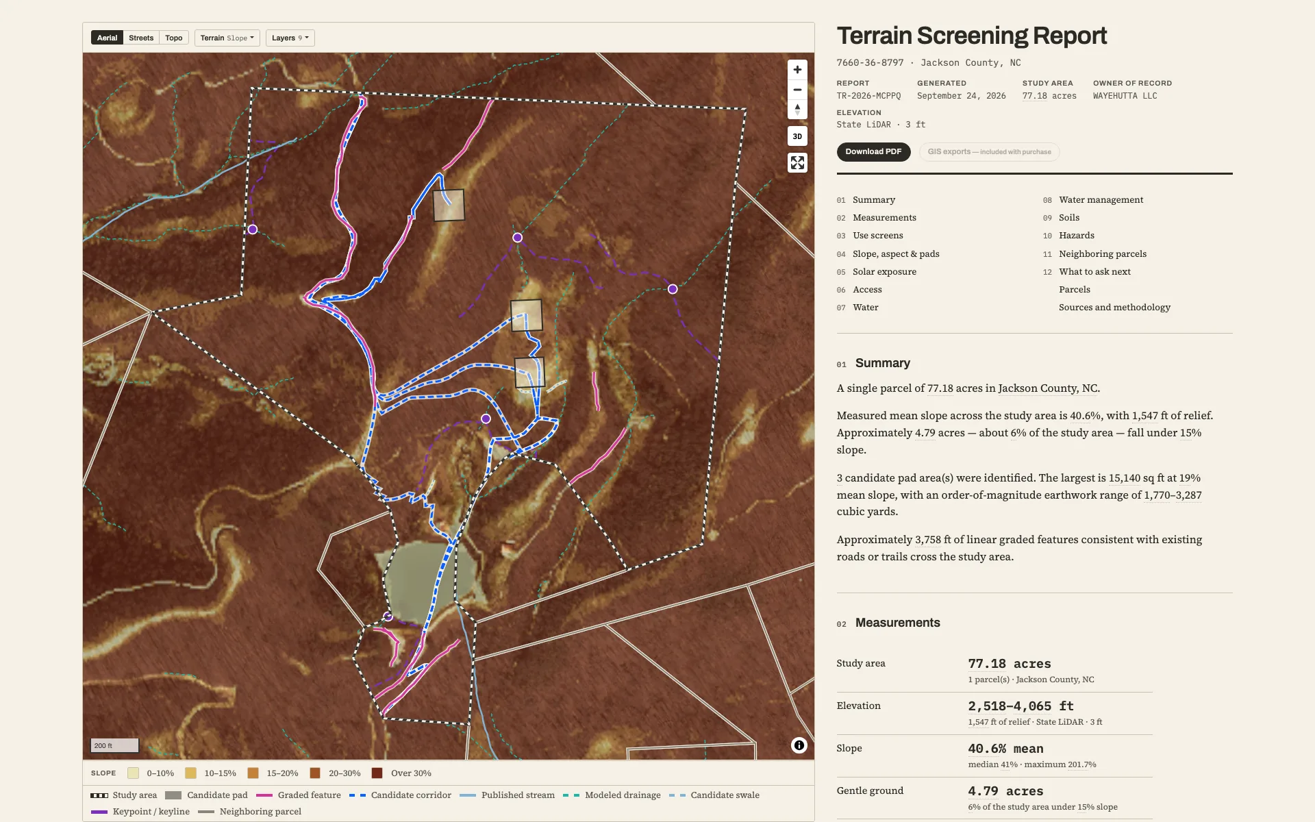
- Slope, mapped from bare-earth LiDAR
- Candidate pads, ranked
- Driveway corridors, costed by grade
- Drainage, swales and keypoints, modeled
- Neighboring parcels, owner by owner
- Every number measured and cited
How it works
Pick the parcel
Search the map and click your parcel. The boundary and acreage come from public records.
Order it
Pay one flat price set by how many parcels you select, never by acreage. There is no account: the link we email you is your access.
Read it
Your link arrives in about a minute and opens the report: an interactive map, a print-ready PDF, and GIS exports.
Inside the report
- Slope, mappedFive slope classes from bare-earth LiDAR, with the source and resolution named on the map.
- Usable acreageAcres of usable ground in each class — mapped, not averaged into one number.
- Candidate building padsRanked by achievable size, each with an order-of-magnitude cut-and-fill range.
- Driveway corridorsRoutes from the named public road to each pad, with length, average and steepest grade, and stream crossings.
- Where the water goesPublished streams, plus drainage modeled from the LiDAR itself.
- Wells on recordRecorded groundwater wells near the parcel from the USGS record, with published well depths.
- Solar exposureTerrain-shaded sun hours with tree-canopy context, a winter-sun map view, and an indicative kWh figure.
- Aspect & viewsWhich way the ground faces — overall and for the gentle acres you would actually build on.
- Water in the landscapeCandidate swale lines, pond areas and keypoints with local rainfall on each catchment, plus a micro-hydro screening range — permaculture and keyline practice, read from the measured terrain.
- Neighboring parcelsEvery adjoining parcel from the county record — owner, acreage, and whether the name reads as individual, company, trust or public land.
- Published context layersUSDA soils, FEMA flood zones, NWI wetlands, landslide inventory — as published, attributed.
- The evidenceEvery figure cites its source; the raw analysis ships with the report.
GIS exports included — pads, corridors and every measured layer, ready for QGIS, ArcGIS or Google Earth:GeoPackageGeoJSONKMLShapefile
What you get that other screening tools don’t
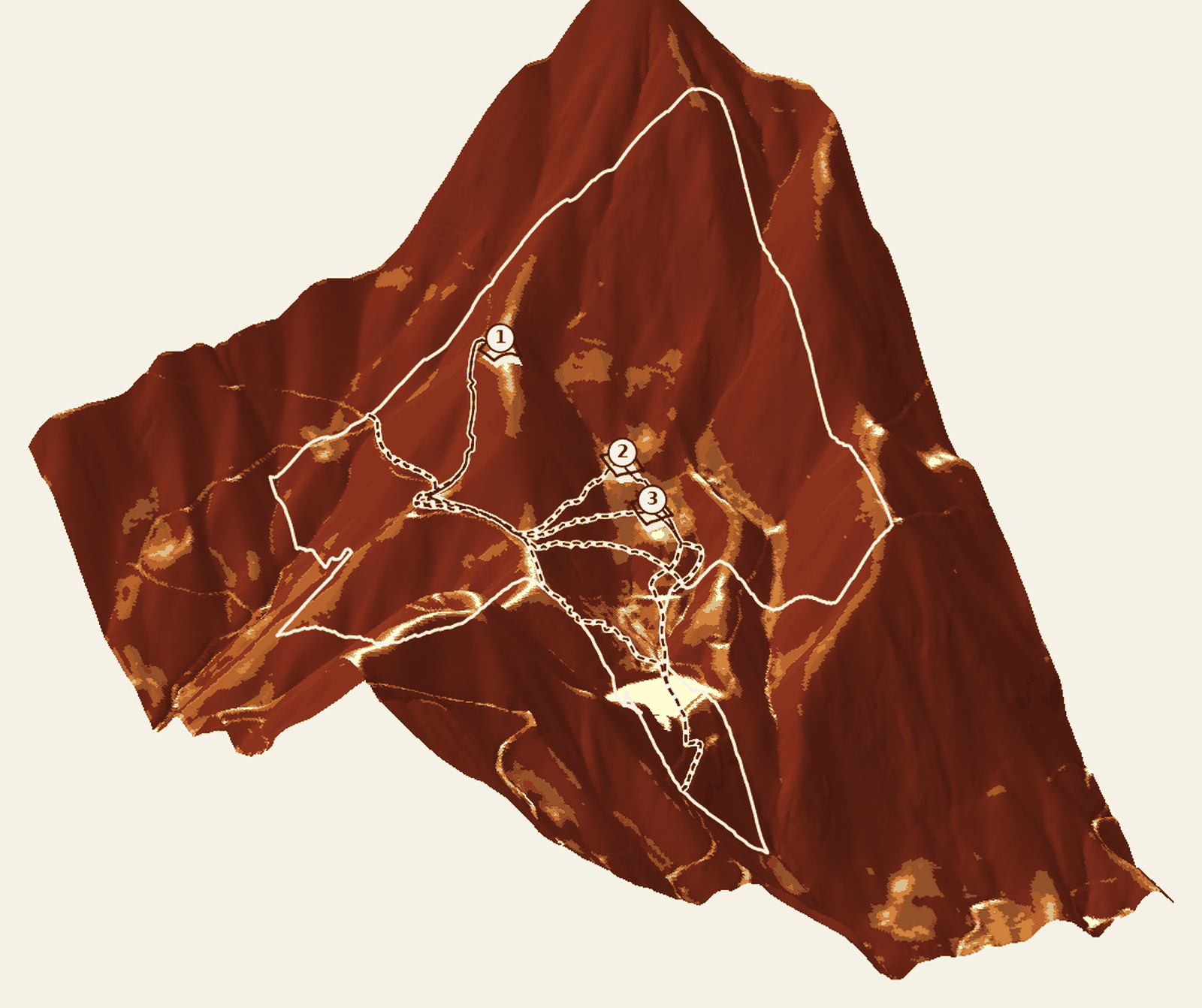
- The pads are found for you
- Other tools ask you to place a house, then price whatever you drew. We search the whole parcel and return candidate pads, ranked, each with an earthwork range to bench it.
- Driveways costed against the hill
- Corridors are routed to each pad by the grade of every step, reusing graded ground already cut into the hillside — a route the terrain allows, not a straight line with a price on it.
- Water, read from the ground itself
- Most tools trace published streams onto a basemap. We model where water actually moves on the measured terrain — then screen candidate swale lines, pond areas, keypoints and a micro-hydro range from it, with local rainfall on every catchment.
- Who holds the land around it
- Every adjoining parcel, and the ring beyond it, from the county record — each owner’s name read as individual, company, trust or public land. A national forest across the line reads differently from an LLC.
- Bare earth, stated on every report
- Surface models measure treetops — on wooded land every number goes wrong while still looking plausible. We run only on bare-earth terrain models, and name the source and resolution on every report.
Who it’s for
Land buyers
See how much of the parcel you could use — and where — while there is still time to negotiate.
Homesteaders
Find the benches and flat spots, see where the water goes, and know what reaching them takes.
Agents & brokers
A measured answer to the first question every buyer asks about steep land.
Small developers
Up to eight parcels as one study area, with GIS exports that open straight in QGIS or ArcGIS.
Off-grid & solar planning
Winter sun hours and terrain shading, measured before you commit to a site or a panel budget.
Hunters & recreational owners
Trail-grade ground, existing roads and water — what the land offers before improvements.
Pricing
You pay one flat price per order, set by parcel count — acreage never changes it. Every tier includes the report, the PDF, and the GIS exports, usually ready in a minute or two.
Start with your own parcel.
Pick the parcel you own — or the one you’re considering — and read its measurements before you commit.